
Vallamand topographic map
Interactive map
Click on the map to display elevation.
About this map
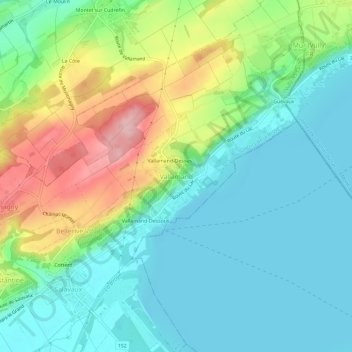
Name: Vallamand topographic map, elevation, terrain.
Location: Vallamand, District de la Broye-Vully, Vaud, 1586, Svizzera (46.90997 7.02008 46.94997 7.06008)
Average elevation: 1,552 ft
Minimum elevation: 1,385 ft
Maximum elevation: 1,939 ft