
Nong Khai Province topographic map
Interactive map
Click on the map to display elevation.
About this map
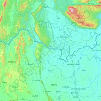
Name: Nong Khai Province topographic map, elevation, terrain.
Location: Nong Khai Province, Thailand (17.59083 102.05835 18.30402 103.41277)
Average elevation: 906 ft
Minimum elevation: 492 ft
Maximum elevation: 5,322 ft
Other topographic maps
Click on a map to view its topography, its elevation and its terrain.
Nong Khai
Nong Khai, Pho Chai, Nong Khai Province, 43000, Thailand
Average elevation: 551 ft