
Ba Vì District topographic map
Interactive map
Click on the map to display elevation.
About this map
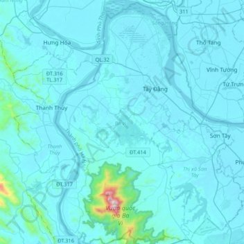
Name: Ba Vì District topographic map, elevation, terrain.
Location: Ba Vì District, Hanoi, Vietnam (21.00745 105.28490 21.30688 105.47401)
Average elevation: 180 ft
Minimum elevation: 10 ft
Maximum elevation: 4,032 ft
Other topographic maps
Click on a map to view its topography, its elevation and its terrain.
Hai Bà Trưng
Vietnam > Hanoi > Hai Bà Trưng
Hai Bà Trưng, Hai Ba Trung District, Hanoi, 10999, Vietnam
Average elevation: 36 ft