
Hacklebarney State Park topographic map
Interactive map
Click on the map to display elevation.
About this map
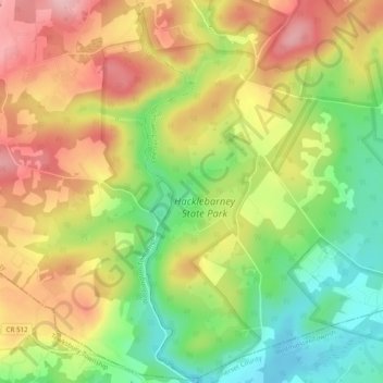
Name: Hacklebarney State Park topographic map, elevation, terrain.
Average elevation: 545 ft
Minimum elevation: 246 ft
Maximum elevation: 846 ft
Other topographic maps
Click on a map to view its topography, its elevation and its terrain.
Hacklebarney
United States of America > New Jersey > Chester Township > Hacklebarney
Hacklebarney, Chester Township, Morris County, New Jersey, 07930, United States of America
Average elevation: 755 ft