
Tihange topographic map
Interactive map
Click on the map to display elevation.
About this map
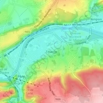
Name: Tihange topographic map, elevation, terrain.
Location: Tihange, Huy, Liège, Wallonia, 4500, Belgium (50.50759 5.23937 50.54759 5.27937)
Average elevation: 420 ft
Minimum elevation: 180 ft
Maximum elevation: 807 ft