
Tiéningboué topographic map
Interactive map
Click on the map to display elevation.
About this map
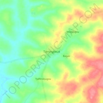
Name: Tiéningboué topographic map, elevation, terrain.
Location: Tiéningboué, Béré, Woroba, Côte d'Ivoire (8.13858 -5.76209 8.21858 -5.68209)
Average elevation: 1,024 ft
Minimum elevation: 892 ft
Maximum elevation: 1,214 ft