
Port de Boucharo topographic map
Interactive map
Click on the map to display elevation.
About this map
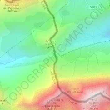
Name: Port de Boucharo topographic map, elevation, terrain.
Average elevation: 7,838 ft
Minimum elevation: 6,322 ft
Maximum elevation: 10,289 ft
Other topographic maps
Click on a map to view its topography, its elevation and its terrain.
Viu de Linás
Espagne > Aragon > Sobrarbe > Torla-Ordesa
Viu de Linás, Torla-Ordesa, Sobrarbe, Huesca, Aragon, 22377, Espagne
Average elevation: 4,390 ft
Linás de Broto
Espagne > Aragon > Sobrarbe > Torla-Ordesa
Linás de Broto, Torla-Ordesa, Sobrarbe, Huesca, Aragon, 22378, Espagne
Average elevation: 4,728 ft