
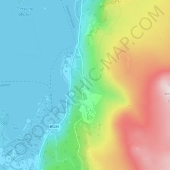
Ashness Bridge topographic map
Interactive map
Click on the map to display elevation.
About this map
Name: Ashness Bridge topographic map, elevation, terrain.
Average elevation: 791 ft
Minimum elevation: 243 ft
Maximum elevation: 1,903 ft
Other topographic maps
Click on a map to view its topography, its elevation and its terrain.
Cockermouth
United Kingdom > England > Allerdale > Cockermouth
Cockermouth, Allerdale, Cumbria, North West England, England, CA13 9PG, United Kingdom
Average elevation: 344 ft
Great Hollow
United Kingdom > England > Allerdale
Great Hollow, Allerdale, Cumbria, North West England, England, CA12 5XG, United Kingdom
Average elevation: 1,339 ft
Walla Crag
United Kingdom > England > Allerdale
Walla Crag, Allerdale, Cumbria, North West England, England, CA12 4AN, United Kingdom
Average elevation: 741 ft