
Bornhöved topographic map
Interactive map
Click on the map to display elevation.
About this map
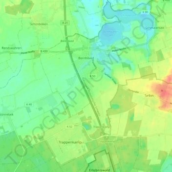
Name: Bornhöved topographic map, elevation, terrain.
Location: Bornhöved, Kreis Segeberg, Schleswig-Holstein, 24619, Germany (54.02799 10.19753 54.09119 10.26938)
Average elevation: 151 ft
Minimum elevation: 85 ft
Maximum elevation: 262 ft
Other topographic maps
Click on a map to view its topography, its elevation and its terrain.
Norderstedt
Germany > Schleswig-Holstein > Kreis Segeberg
Norderstedt, Kreis Segeberg, Schleswig-Holstein, Germany
Average elevation: 95 ft
Kaltenkirchen
Germany > Schleswig-Holstein > Kreis Segeberg
Kaltenkirchen, Kreis Segeberg, Schleswig-Holstein, 24568, Germany
Average elevation: 105 ft