
Eagles Nest Wilderness Area topographic map
Interactive map
Click on the map to display elevation.
About this map
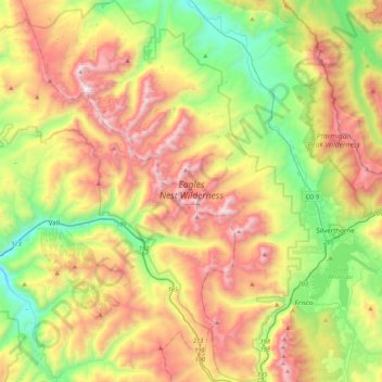
Name: Eagles Nest Wilderness Area topographic map, elevation, terrain.
Average elevation: 10,200 ft
Minimum elevation: 7,808 ft
Maximum elevation: 13,468 ft