
Gramais topographic map
Interactive map
Click on the map to display elevation.
About this map
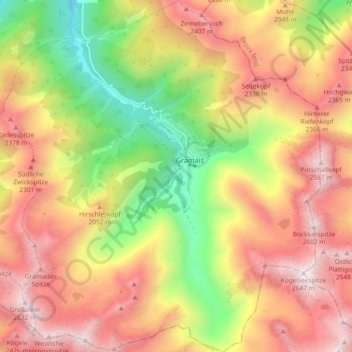
Name: Gramais topographic map, elevation, terrain.
Location: Gramais, Reutte (Außerfern), Tirol, 6650, Österreich (47.23356 10.48601 47.29656 10.56974)
Average elevation: 6,293 ft
Minimum elevation: 3,629 ft
Maximum elevation: 8,599 ft