
Montross topographic map
Interactive map
Click on the map to display elevation.
About this map
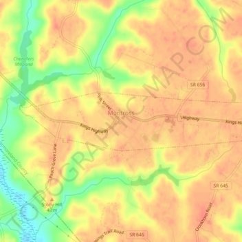
Name: Montross topographic map, elevation, terrain.
Location: Montross, Westmoreland County, Virginia, United States (38.08973 -76.84650 38.09833 -76.80163)
Average elevation: 121 ft
Minimum elevation: 16 ft
Maximum elevation: 167 ft
Other topographic maps
Click on a map to view its topography, its elevation and its terrain.
Latanes Pond
United States > Virginia > Westmoreland County > Laurel Grove
Latanes Pond, Laurel Grove, Westmoreland County, Virginia, United States
Average elevation: 30 ft
Colonial Beach
United States > Virginia > Westmoreland County
Colonial Beach, Westmoreland County, Virginia, United States
Average elevation: 7 ft
Kinsale
United States > Virginia > Westmoreland County
Kinsale, Westmoreland County, Virginia, 22488, United States
Average elevation: 46 ft