
Weener topographic map
Interactive map
Click on the map to display elevation.
About this map
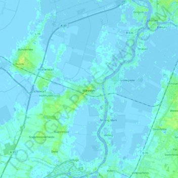
Name: Weener topographic map, elevation, terrain.
Location: Weener, Landkreis Leer, Lower Saxony, 26826, Germany (53.10092 7.24675 53.23048 7.41148)
Average elevation: 3 ft
Minimum elevation: -20 ft
Maximum elevation: 36 ft