
Thorn Hill topographic map
Interactive map
Click on the map to display elevation.
About this map
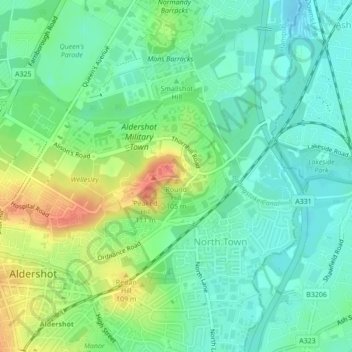
Name: Thorn Hill topographic map, elevation, terrain.
Average elevation: 262 ft
Minimum elevation: 207 ft
Maximum elevation: 367 ft
Other topographic maps
Click on a map to view its topography, its elevation and its terrain.
Rushmoor
United Kingdom > England > Rushmoor
Rushmoor, Hampshire, South East, England, United Kingdom
Average elevation: 285 ft