
Schouwen topographic map
Interactive map
Click on the map to display elevation.
About this map
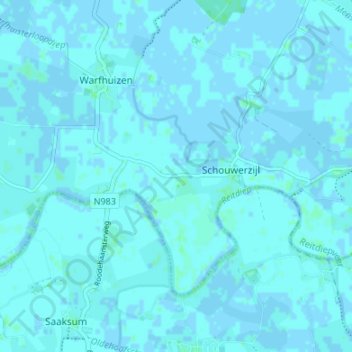
Name: Schouwen topographic map, elevation, terrain.
Location: Schouwen, Groningen, Niederlande, 9962, Niederlande (53.31021 6.41899 53.35021 6.45899)
Average elevation: 3 ft
Minimum elevation: -7 ft
Maximum elevation: 13 ft