
Warburton topographic map
Interactive map
Click on the map to display elevation.
About this map
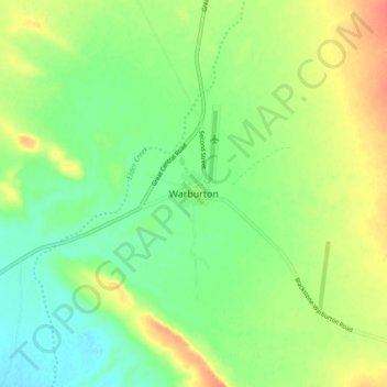
Name: Warburton topographic map, elevation, terrain.
Location: Warburton, Western Australia, 6431, Australia (-26.17555 126.53868 -26.09555 126.61868)
Average elevation: 1,519 ft
Minimum elevation: 1,457 ft
Maximum elevation: 1,601 ft