
Tegel topographic map
Interactive map
Click on the map to display elevation.
About this map
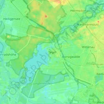
Name: Tegel topographic map, elevation, terrain.
Location: Tegel, Reinickendorf, Berlin, Germany (52.54881 13.22098 52.62613 13.32154)
Average elevation: 128 ft
Minimum elevation: 85 ft
Maximum elevation: 223 ft
Other topographic maps
Click on a map to view its topography, its elevation and its terrain.