
Izúcar de Matamoros topographic map
Interactive map
Click on the map to display elevation.
About this map
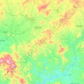
Name: Izúcar de Matamoros topographic map, elevation, terrain.
Location: Izúcar de Matamoros, Puebla, México (18.32943 -98.56538 18.68354 -98.28775)
Average elevation: 4,232 ft
Minimum elevation: 3,081 ft
Maximum elevation: 6,742 ft
Other topographic maps
Click on a map to view its topography, its elevation and its terrain.
Izúcar
México > Puebla > Izúcar de Matamoros
Izúcar, Izúcar de Matamoros, Puebla, 74400, México
Average elevation: 4,275 ft