
Chitgar topographic map
Interactive map
Click on the map to display elevation.
About this map
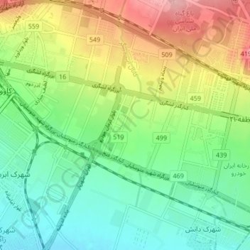
Name: Chitgar topographic map, elevation, terrain.
Average elevation: 3,957 ft
Minimum elevation: 3,776 ft
Maximum elevation: 4,268 ft
Other topographic maps
Click on a map to view its topography, its elevation and its terrain.
Darakeh River
Iran > Tehran Province > Tehran
Darakeh River, Tehran, بخش مرکزی شهرستان تهران, Tehran County, Tehran Province, 147169, Iran
Average elevation: 4,190 ft