
العرب topographic map
Interactive map
Click on the map to display elevation.
About this map
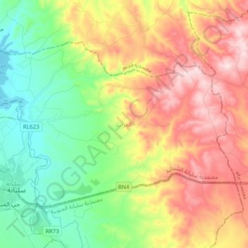
Name: العرب topographic map, elevation, terrain.
Location: العرب, سليانة الشمالية, Siliana, Tunisia (36.07619 9.35704 36.15693 9.50681)
Average elevation: 1,857 ft
Minimum elevation: 1,253 ft
Maximum elevation: 2,657 ft
Other topographic maps
Click on a map to view its topography, its elevation and its terrain.