
La Esperanza topographic map
Interactive map
Click on the map to display elevation.
About this map
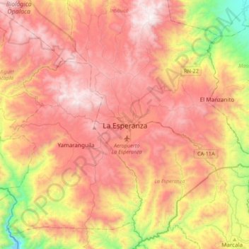
Name: La Esperanza topographic map, elevation, terrain.
Location: La Esperanza, Intibucá, Honduras (14.14893 -88.33704 14.46893 -88.01704)
Average elevation: 5,033 ft
Minimum elevation: 1,768 ft
Maximum elevation: 7,579 ft
Other topographic maps
Click on a map to view its topography, its elevation and its terrain.
Cerro El Pelón
Honduras > Intibucá > La Esperanza
Cerro El Pelón, La Esperanza, Intibucá, Honduras
Average elevation: 6,276 ft
Río Guarajambala
Honduras > Intibucá > La Esperanza
Río Guarajambala, La Esperanza, Intibucá, Honduras
Average elevation: 1,604 ft