
Yoro topographic map
Interactive map
Click on the map to display elevation.
About this map
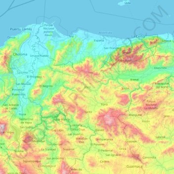
Name: Yoro topographic map, elevation, terrain.
Location: Yoro, Honduras (14.87476 -87.93822 15.72508 -86.22860)
Average elevation: 1,837 ft
Minimum elevation: -3 ft
Maximum elevation: 8,852 ft
Other topographic maps
Click on a map to view its topography, its elevation and its terrain.