
Trujillo topographic map
Interactive map
Click on the map to display elevation.
About this map
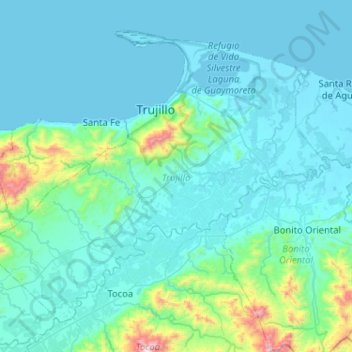
Name: Trujillo topographic map, elevation, terrain.
Location: Trujillo, Colón, Honduras (15.61726 -86.21346 16.02771 -85.69858)
Average elevation: 463 ft
Minimum elevation: -3 ft
Maximum elevation: 4,879 ft
Other topographic maps
Click on a map to view its topography, its elevation and its terrain.