
Ste. Rose du Lac topographic map
Interactive map
Click on the map to display elevation.
About this map
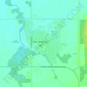
Name: Ste. Rose du Lac topographic map, elevation, terrain.
Location: Ste. Rose du Lac, Division No 17, Manitoba, R0L 1S0, Canada (51.05176 -99.53105 51.06651 -99.50646)
Average elevation: 876 ft
Minimum elevation: 860 ft
Maximum elevation: 909 ft