
Stanstead topographic map
Interactive map
Click on the map to display elevation.
About this map
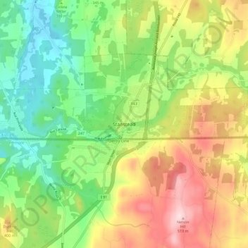
Name: Stanstead topographic map, elevation, terrain.
Location: Stanstead, Memphrémagog, Estrie, Québec, J0B 3E2, Canada (44.97066 -72.13725 45.05066 -72.05725)
Average elevation: 1,083 ft
Minimum elevation: 636 ft
Maximum elevation: 1,716 ft