
Granby topographic map
Interactive map
Click on the map to display elevation.
About this map
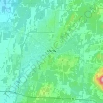
Name: Granby topographic map, elevation, terrain.
Location: Granby, La Haute-Yamaska, Estrie, Quebec, Canada (45.33756 -72.84590 45.45792 -72.66334)
Average elevation: 397 ft
Minimum elevation: 184 ft
Maximum elevation: 1,509 ft
Other topographic maps
Click on a map to view its topography, its elevation and its terrain.
Shefford
Canada > Quebec > La Haute-Yamaska
Shefford, La Haute-Yamaska, Estrie, Quebec, Canada
Average elevation: 692 ft