
Lac-Mégantic topographic map
Interactive map
Click on the map to display elevation.
About this map
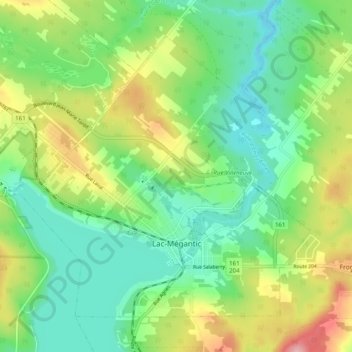
Name: Lac-Mégantic topographic map, elevation, terrain.
Location: Lac-Mégantic, Le Granit, Estrie, Quebec, Canada (45.56271 -70.94362 45.61825 -70.84427)
Average elevation: 1,424 ft
Minimum elevation: 1,247 ft
Maximum elevation: 1,759 ft
Other topographic maps
Click on a map to view its topography, its elevation and its terrain.
Lac Whitton
Canada > Quebec > Le Granit > Nantes
Lac Whitton, Nantes, Le Granit, Estrie, Quebec, Canada
Average elevation: 1,621 ft