
El Retiro topographic map
Interactive map
Click on the map to display elevation.
About this map
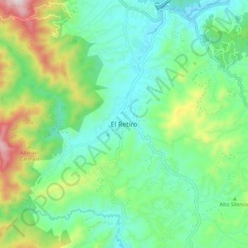
Name: El Retiro topographic map, elevation, terrain.
Location: El Retiro, Retiro, Oriente, Antioquia, 055437, Colombia (6.01727 -75.54261 6.09727 -75.46261)
Average elevation: 7,579 ft
Minimum elevation: 6,942 ft
Maximum elevation: 9,186 ft