
Samalayuca topographic map
Interactive map
Click on the map to display elevation.
About this map
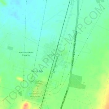
Name: Samalayuca topographic map, elevation, terrain.
Location: Samalayuca, Juárez, Chihuahua, México (31.32385 -106.49834 31.36385 -106.45834)
Average elevation: 4,173 ft
Minimum elevation: 4,121 ft
Maximum elevation: 4,291 ft