
Tonalá topographic map
Interactive map
Click on the map to display elevation.
About this map
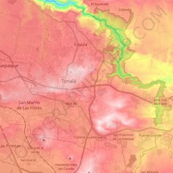
Name: Tonalá topographic map, elevation, terrain.
Location: Tonalá, Jalisco, Mexico (20.53134 -103.28673 20.70569 -103.13701)
Average elevation: 5,033 ft
Minimum elevation: 3,593 ft
Maximum elevation: 5,715 ft