
Silca topographic map
Interactive map
Click on the map to display elevation.
About this map
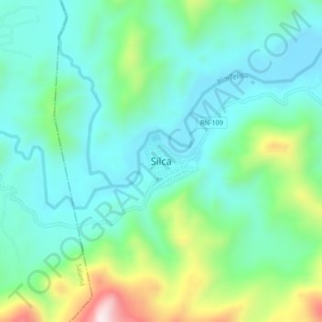
Name: Silca topographic map, elevation, terrain.
Location: Silca, Olancho, Honduras (14.79078 -86.56629 14.83078 -86.52629)
Average elevation: 2,270 ft
Minimum elevation: 1,827 ft
Maximum elevation: 3,576 ft