
Mazatlán topographic map
Interactive map
Click on the map to display elevation.
About this map
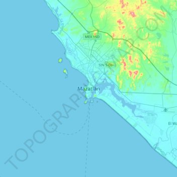
Name: Mazatlán topographic map, elevation, terrain.
Location: Mazatlán, Sinaloa, 82000, Mexico (23.07131 -106.57531 23.39131 -106.25531)
Average elevation: 82 ft
Minimum elevation: -7 ft
Maximum elevation: 902 ft
Its average elevation is 10 metres (33 ft) above sea level.