
Guanaja topographic map
Interactive map
Click on the map to display elevation.
About this map
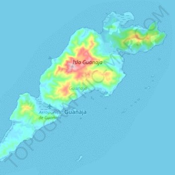
Name: Guanaja topographic map, elevation, terrain.
Location: Guanaja, Bonacca, Islas de la Bahía, Honduras (16.40239 -85.95184 16.51596 -85.81562)
Average elevation: 75 ft
Minimum elevation: -3 ft
Maximum elevation: 1,316 ft