
Fehring topographic map
Interactive map
Click on the map to display elevation.
About this map
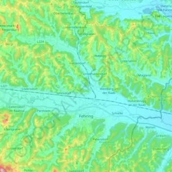
Name: Fehring topographic map, elevation, terrain.
Location: Fehring, Bezirk Südoststeiermark, Steiermark, 8350, Österreich (46.89278 15.93788 47.02510 16.09634)
Average elevation: 1,020 ft
Minimum elevation: 794 ft
Maximum elevation: 1,847 ft
Other topographic maps
Click on a map to view its topography, its elevation and its terrain.
Hatzendorf
Österreich > Steiermark > Bezirk Südoststeiermark > Fehring > Hatzendorf
Hatzendorf, Fehring, Bezirk Südoststeiermark, Steiermark, 8350, Österreich
Average elevation: 1,004 ft