
Marktgemeinde Reutte topographic map
Interactive map
Click on the map to display elevation.
About this map
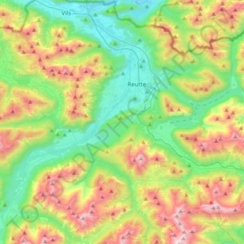
Name: Marktgemeinde Reutte topographic map, elevation, terrain.
Location: Marktgemeinde Reutte, Bezirk Reutte, Tirol, 6600, Österreich (47.37587 10.61305 47.53731 10.91860)
Average elevation: 4,485 ft
Minimum elevation: 2,579 ft
Maximum elevation: 8,012 ft