
Schrems topographic map
Interactive map
Click on the map to display elevation.
About this map
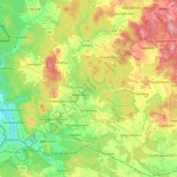
Name: Schrems topographic map, elevation, terrain.
Location: Schrems, Bezirk Gmünd, Niederösterreich, Österreich (48.74663 15.01007 48.87125 15.14753)
Average elevation: 1,788 ft
Minimum elevation: 1,532 ft
Maximum elevation: 2,126 ft