
Pinneberg topographic map
Interactive map
Click on the map to display elevation.
About this map
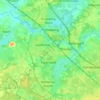
Name: Pinneberg topographic map, elevation, terrain.
Location: Pinneberg, Schleswig-Holstein, Germany (53.60863 9.76364 53.68387 9.82868)
Average elevation: 39 ft
Minimum elevation: 0 ft
Maximum elevation: 112 ft