
Gerolstein topographic map
Interactive map
Click on the map to display elevation.
About this map
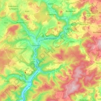
Name: Gerolstein topographic map, elevation, terrain.
Location: Gerolstein, Landkreis Vulkaneifel, Rhineland-Palatinate, Germany (50.15631 6.56115 50.26348 6.73677)
Average elevation: 1,591 ft
Minimum elevation: 1,053 ft
Maximum elevation: 2,224 ft