
Ribadesella topographic map
Interactive map
Click on the map to display elevation.
About this map
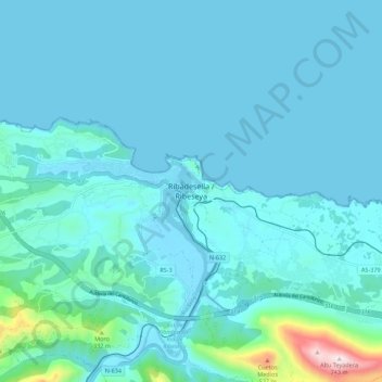
Name: Ribadesella topographic map, elevation, terrain.
Location: Ribadesella, Asturias, 33560, España (43.42171 -5.09875 43.50171 -5.01875)
Average elevation: 220 ft
Minimum elevation: -10 ft
Maximum elevation: 2,405 ft
Other topographic maps
Click on a map to view its topography, its elevation and its terrain.
Llovio
España > Asturias > Ribadesella > Llovio
Llovio, Ribadesella, Asturias, 33560, España
Average elevation: 338 ft