
Travenbrück topographic map
Interactive map
Click on the map to display elevation.
About this map
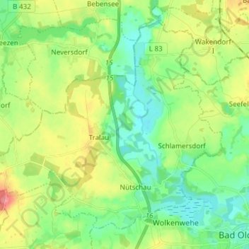
Name: Travenbrück topographic map, elevation, terrain.
Average elevation: 98 ft
Minimum elevation: 13 ft
Maximum elevation: 249 ft
Other topographic maps
Click on a map to view its topography, its elevation and its terrain.
Tralau
Deutschland > Schleswig-Holstein > Travenbrück > Tralau
Tralau, Travenbrück, Bad Oldesloe-Land, Stormarn, Schleswig-Holstein, 23845, Deutschland
Average elevation: 98 ft