
Gáldar topographic map
Interactive map
Click on the map to display elevation.
About this map
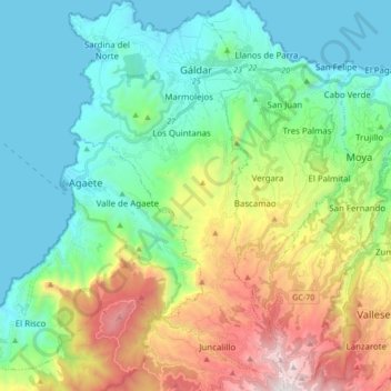
Name: Gáldar topographic map, elevation, terrain.
Location: Gáldar, Las Palmas, Canary Islands, 35460, Spain (28.01942 -15.70970 28.17096 -15.61387)
Average elevation: 1,644 ft
Minimum elevation: 0 ft
Maximum elevation: 5,745 ft