
Puyehue topographic map
Interactive map
Click on the map to display elevation.
About this map
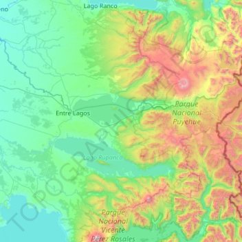
Name: Puyehue topographic map, elevation, terrain.
Average elevation: 1,877 ft
Minimum elevation: 115 ft
Maximum elevation: 8,714 ft
Other topographic maps
Click on a map to view its topography, its elevation and its terrain.
Río Cholguaco
Chile > Los Lagos Region > Provincia de Osorno > Río Negro > Caleta Cóndor
Río Cholguaco, Caleta Cóndor, Río Negro, Provincia de Osorno, Los Lagos Region, Chile
Average elevation: 335 ft