
Rochefort topographic map
Interactive map
Click on the map to display elevation.
About this map
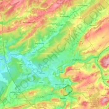
Name: Rochefort topographic map, elevation, terrain.
Location: Rochefort, Namur, Wallonia, Belgium (50.09346 5.05538 50.23827 5.28428)
Average elevation: 778 ft
Minimum elevation: 443 ft
Maximum elevation: 1,398 ft