
Kintamani topographic map
Interactive map
Click on the map to display elevation.
About this map
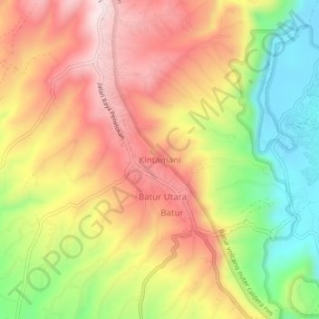
Name: Kintamani topographic map, elevation, terrain.
Location: Kintamani, Bangli, Bali, Indonesia (-8.27056 115.31301 -8.23056 115.35301)
Average elevation: 4,295 ft
Minimum elevation: 3,504 ft
Maximum elevation: 4,984 ft
Other topographic maps
Click on a map to view its topography, its elevation and its terrain.