
Woodstock topographic map
Interactive map
Click on the map to display elevation.
About this map
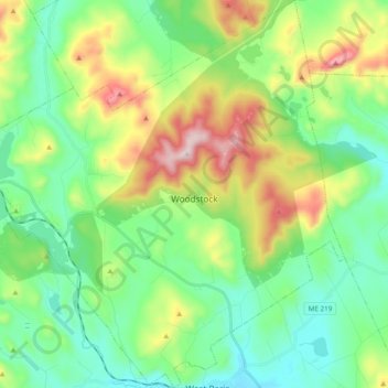
Name: Woodstock topographic map, elevation, terrain.
Location: Woodstock, Oxford County, Maine, 04219, United States (44.32472 -70.69424 44.46214 -70.50596)
Average elevation: 1,037 ft
Minimum elevation: 443 ft
Maximum elevation: 2,392 ft