
Camp Pendleton topographic map
Interactive map
Click on the map to display elevation.
About this map
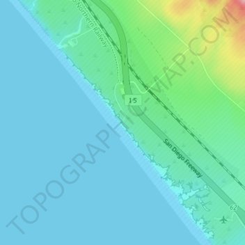
Name: Camp Pendleton topographic map, elevation, terrain.
Average elevation: 79 ft
Minimum elevation: 0 ft
Maximum elevation: 472 ft
Other topographic maps
Click on a map to view its topography, its elevation and its terrain.
Case Springs Dam
United States > California > San Diego County > Marine Corps Base Camp Pendleton
Case Springs Dam, Marine Corps Base Camp Pendleton, San Diego County, California, United States
Average elevation: 2,149 ft
Camp Pendleton South
United States > California > San Diego County > Marine Corps Base Camp Pendleton
Camp Pendleton South, Marine Corps Base Camp Pendleton, San Diego County, California, 92051, United States
Average elevation: 98 ft
San Onofre
United States > California > San Diego County > Marine Corps Base Camp Pendleton
San Onofre, Marine Corps Base Camp Pendleton, San Diego County, CAL Fire Southern Region, California, United States
Average elevation: 89 ft