
Holland topographic map
Interactive map
Click on the map to display elevation.
About this map
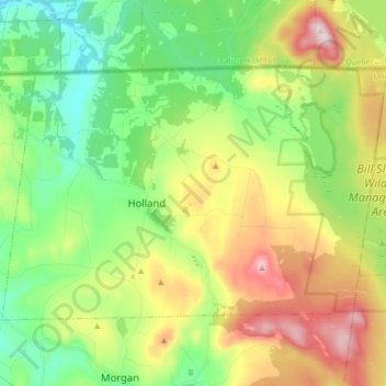
Name: Holland topographic map, elevation, terrain.
Location: Holland, Orleans County, Vermont, 05830, United States (44.93099 -72.06578 45.00837 -71.89931)
Average elevation: 1,545 ft
Minimum elevation: 1,027 ft
Maximum elevation: 2,421 ft
Other topographic maps
Click on a map to view its topography, its elevation and its terrain.
Tice
United States > Vermont > Orleans County > Holland > Tice
Tice, Holland, Orleans County, Vermont, 05830, United States
Average elevation: 1,322 ft