
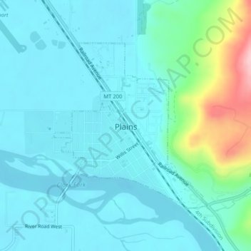
Plains topographic map
Interactive map
Click on the map to display elevation.
About this map
Name: Plains topographic map, elevation, terrain.
Location: Plains, Sanders County, Montana, United States (47.45176 -114.89624 47.46954 -114.87179)
Average elevation: 2,543 ft
Minimum elevation: 2,434 ft
Maximum elevation: 3,071 ft