
Truro topographic map
Interactive map
Click on the map to display elevation.
About this map
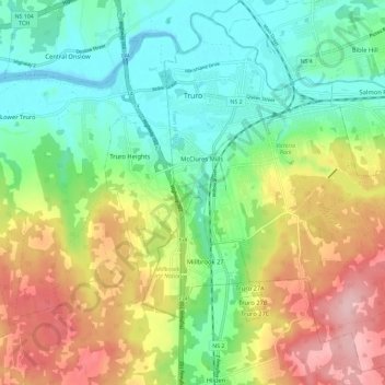
Name: Truro topographic map, elevation, terrain.
Location: Truro, Town of Truro, Colchester County, Nova Scotia, Canada (45.30842 -63.30863 45.38406 -63.19335)
Average elevation: 233 ft
Minimum elevation: -7 ft
Maximum elevation: 607 ft
Other topographic maps
Click on a map to view its topography, its elevation and its terrain.
McClures Mills
Canada > Nova Scotia > Town of Truro > Truro
McClures Mills, Truro, Town of Truro, Colchester County, Nova Scotia, B2N 1A1, Canada
Average elevation: 151 ft