
Red Brook Pond Dam topographic map
Interactive map
Click on the map to display elevation.
About this map
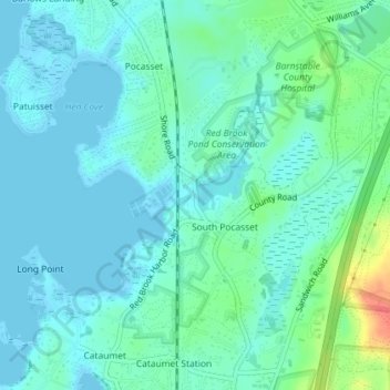
Name: Red Brook Pond Dam topographic map, elevation, terrain.
Average elevation: 39 ft
Minimum elevation: -10 ft
Maximum elevation: 180 ft
Other topographic maps
Click on a map to view its topography, its elevation and its terrain.
Cape Cod Canal
United States > Massachusetts > Barnstable County > Bourne
Cape Cod Canal, Bourne, Barnstable County, Massachusetts, United States
Average elevation: 10 ft
Cape Cod Canal
United States > Massachusetts > Barnstable County > Bourne
Cape Cod Canal, Bourne, Barnstable County, Massachusetts, 02532, United States
Average elevation: 62 ft
Sagamore Beach
United States > Massachusetts > Barnstable County > Bourne > Sagamore Beach
Sagamore Beach, Bourne, Barnstable County, Massachusetts, 02562, United States
Average elevation: 43 ft